
Getting to Know Polibatam’s Geomatics Technology Study Program: Preparing Vocational Talents in Spatial Data and Mapping
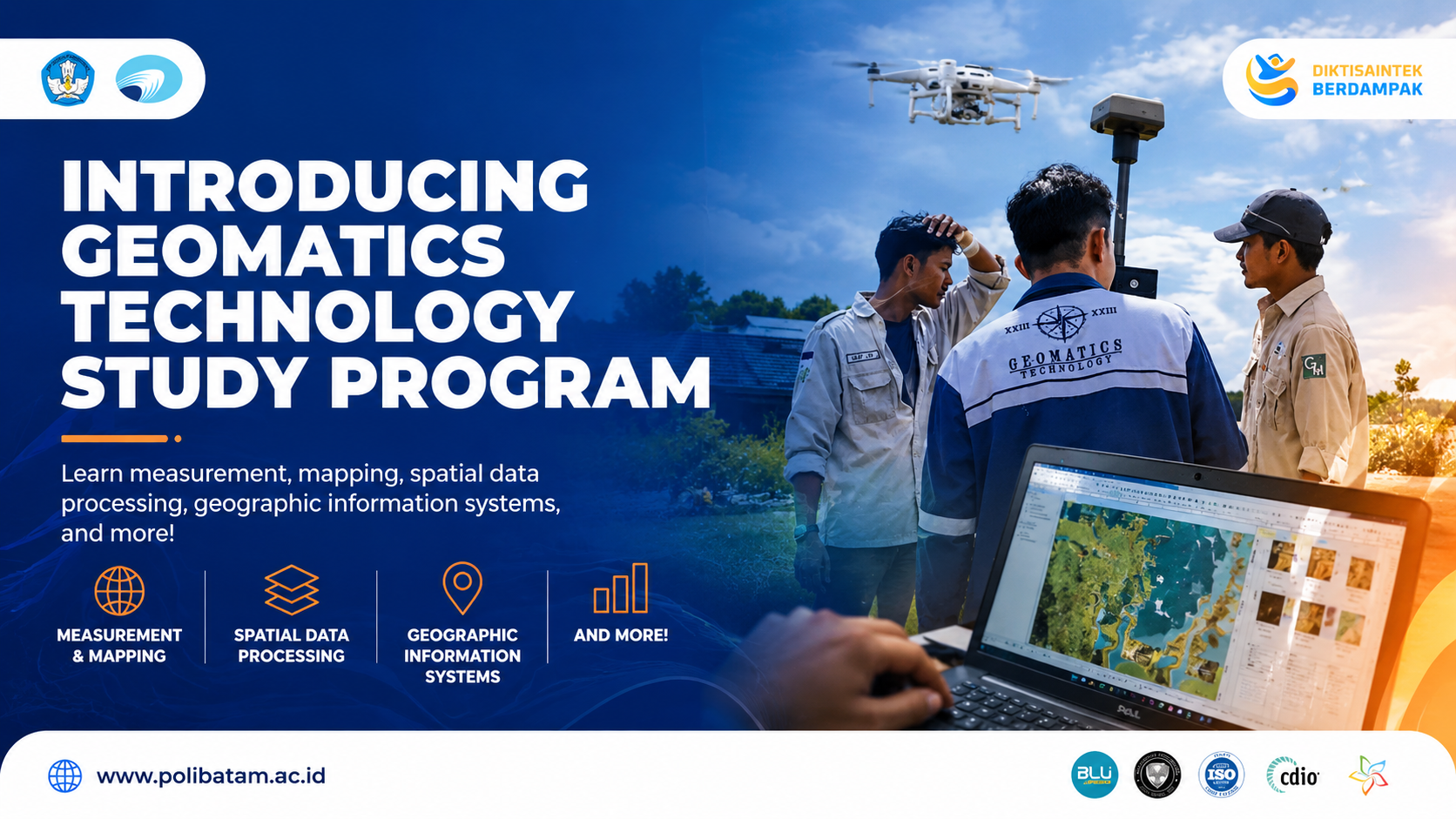
BATAM – Mapping technology plays an important role in various development sectors, ranging from regional planning, environmental management, land administration, marine studies, to infrastructure development. As the need for accurate spatial data continues to grow, competencies in geomatics are becoming increasingly relevant to industry development and regional advancement.
Through the introductory video of the Geomatics Technology Study Program, which can be accessed via Polibatam’s official Instagram at https://www.instagram.com/p/Dafb6a1jQlR/?hl=en, Politeknik Negeri Batam introduces a study program that focuses on measurement, mapping, spatial data processing, geographic information systems, remote sensing, and the use of modern surveying technology. This program is designed to prepare students to understand, process, analyze, and present geospatial data accurately and professionally.
In the Geomatics Technology Study Program, students do not only learn theoretical concepts but are also equipped with practical experience through the use of various tools and supporting technologies that are relevant to industry needs. Practice-based and project-based learning play an important role in developing students’ competencies, particularly in observing field conditions, conducting measurements, processing data, and producing spatial information that can support decision-making.
Competence in geomatics opens wide opportunities for graduates to contribute to various fields, including construction, land administration, urban planning, environmental management, marine sectors, infrastructure, and spatial data-based industries. Through its applied vocational education approach, Polibatam continues to prepare graduates who are adaptive, skilled, and ready to meet the needs of the workforce.
Through the Geomatics Technology Study Program, Polibatam invites prospective students to explore the world of mapping and spatial technology as part of the future of data-driven, precise, and innovative development.
Greetings from Polibatam!
#Polibatam #GeomaticsTechnology #KampusPBL #ImpactfulVocationalEducation #PoliteknikNegeriBatam #DiktisaintekBerdampak